Hwy 49 Traffic Signalization Study
Improving North-South Mobility on the Gulf Coast

Objective:
Improve mobility by reducing traffic congestion and delay
Strategy:
Improve traffic flow by improving intersections system-wide by adding turn lanes, extending turn lanes, improved signalization, and improving operations.
Performance Measure:
Average travel time on mobility corridor

Description
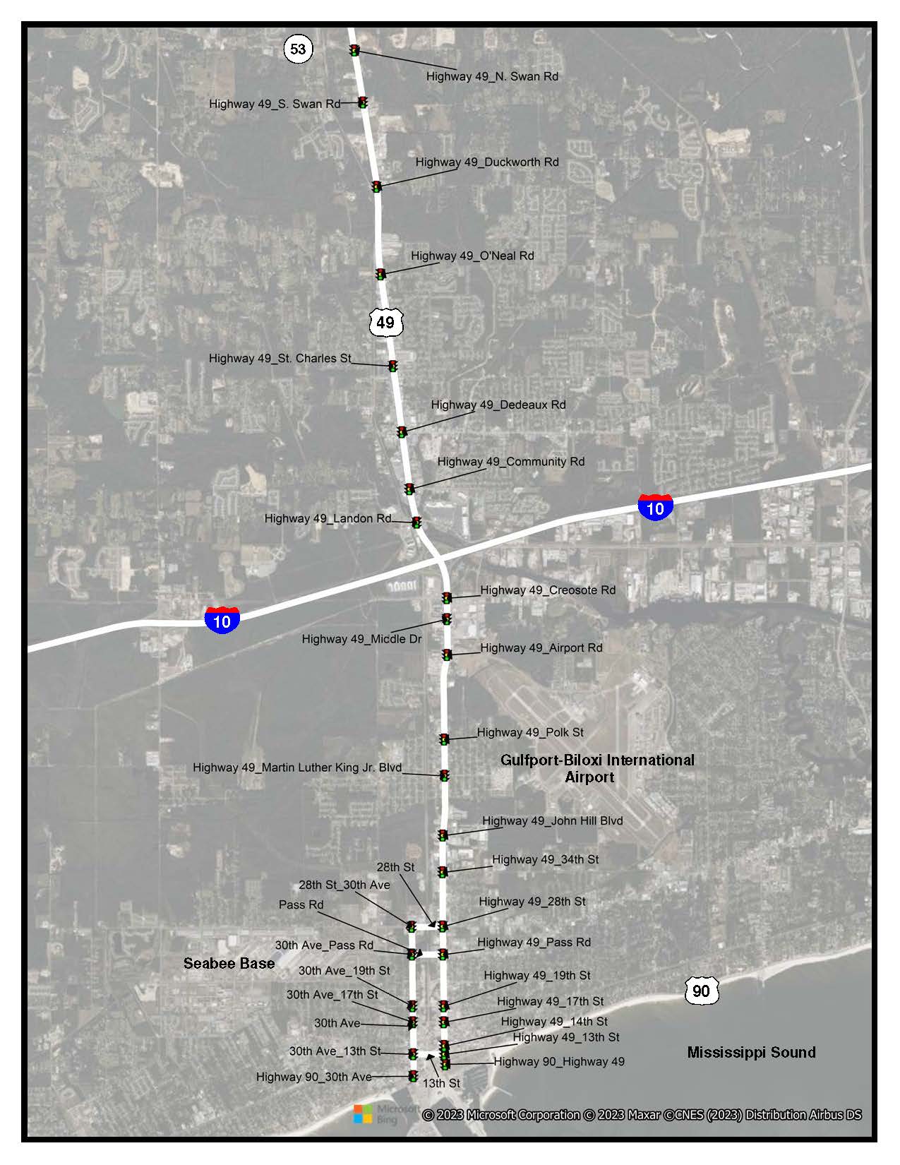
This project aims to produce an area-wide coordinated traffic signal timing plan for intersections in Gulfport, MS, for field implementation that will reduce traffic delays.
The study proposes to produce an area-wide coordinated traffic signal timing plan for a series of intersections along the following corridors: Hwy 49, 30th Avenue, 28th Street, and Canal Road. The study intends to develop a signal timing plan that will improve the traffic flow in the corridor during peak hours of travel, special events, and when ships are in port loading or unloading cargo and detail ITS applications for the corridor(s)
The scope of work will be divided into the following four Tasks:
1) Project Scoping
2) Data Collection
3) Model Development
4) Timing Evaluation.
The Study is funded through the Mississippi Gulf Coast MPO and The Mississippi Port at Gulfport

